If you’re looking for accurate, professional drone surveying services you can rely on, WADIT AERIAL SURVEYS is here to help.
We provide high-quality aerial data capture for inspections, mapping, surveys, and visual reporting—delivered safely, efficiently, and fully compliant with UK aviation regulations. Every project is approached with attention to detail, clear communication, and a commitment to producing results you can confidently use for decision-making, reporting, or planning.
Whether you need a one-off inspection, ongoing monitoring, or tailored aerial data for a specific project, we’ll take the time to understand your requirements and recommend the most effective solution.
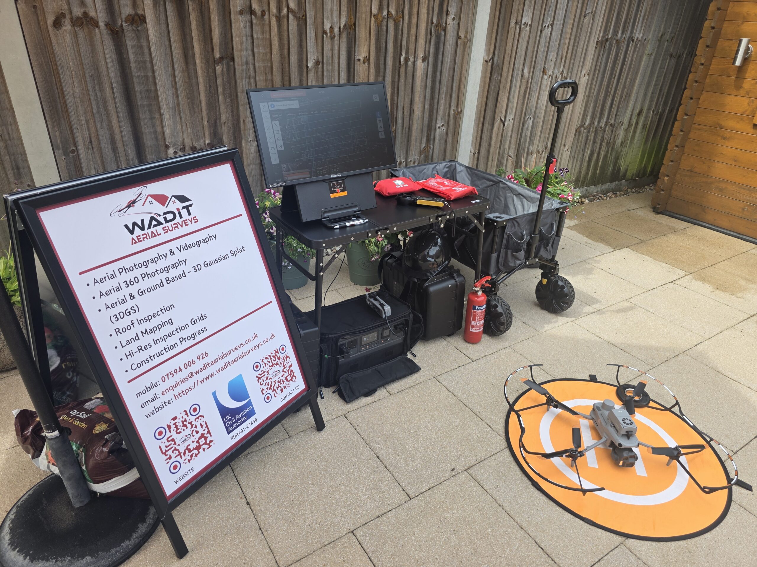
Why contact WADIT AERIAL SURVEYS?
GVC-qualified and fully insured operator
PDRA01 operational authorisation
Safe, non-intrusive data capture
Clear, practical deliverables
Professional service from first enquiry to final output
Get in touch today to discuss your project, request a quotation, or ask for advice.
Complete the enquiry form below and let WADIT AERIAL SURVEYS provide the aerial insight you need.
