Professional Land Mapping with DJI Enterprise Drones
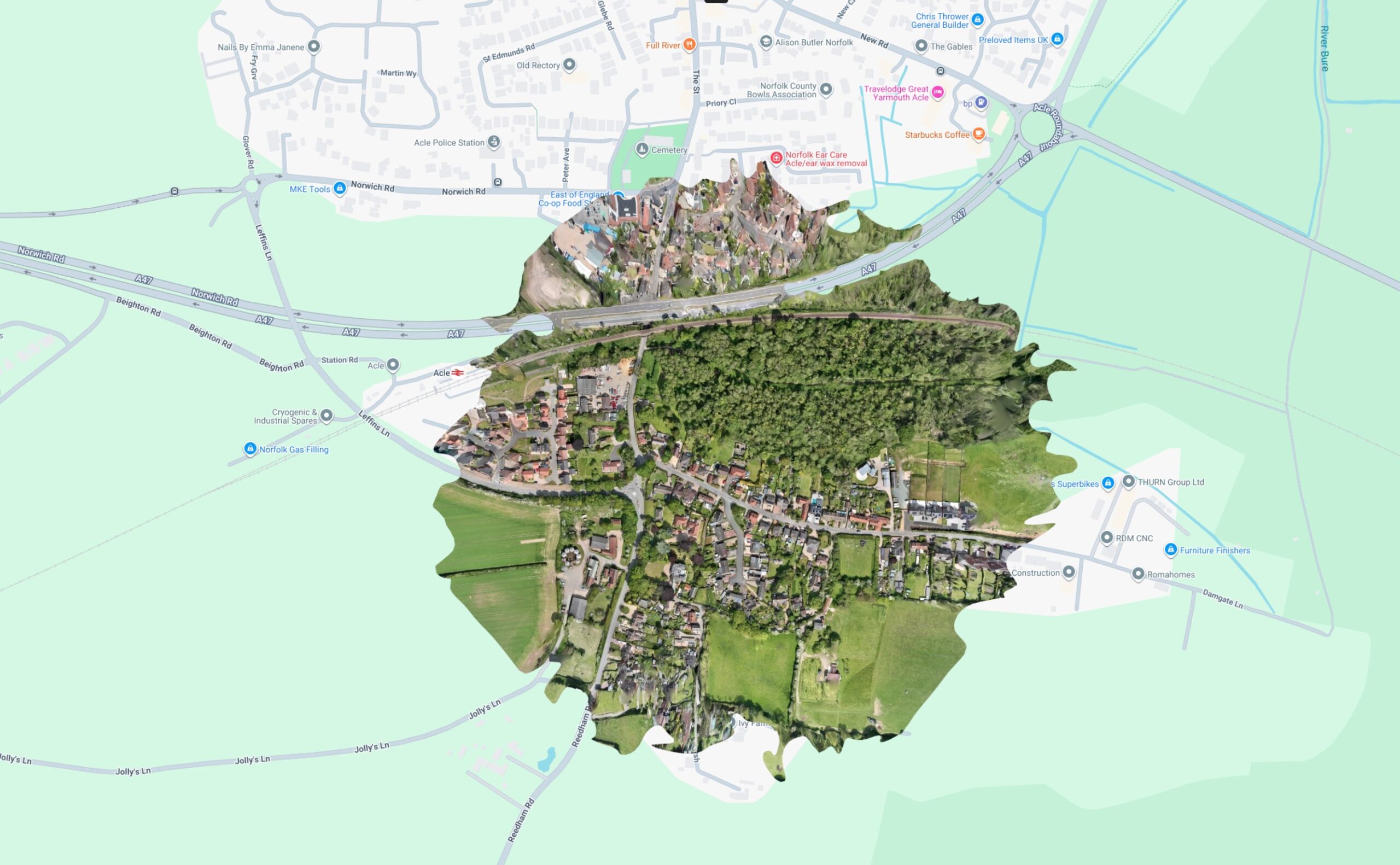
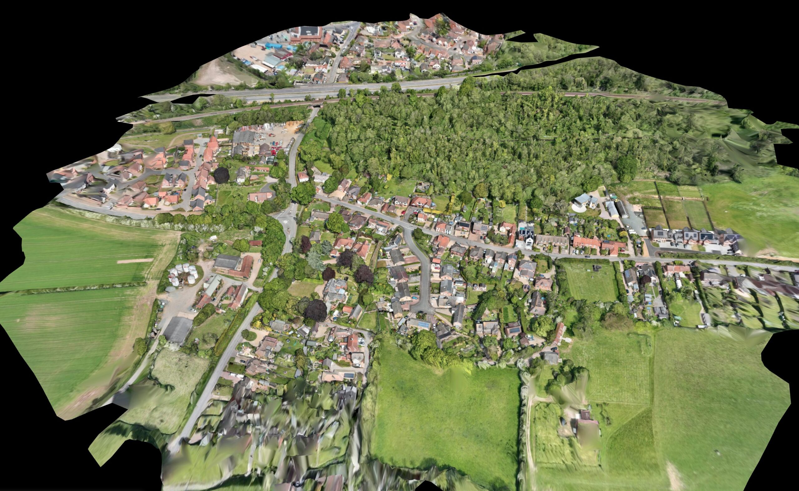
Modern land mapping demands efficiency, accuracy, and regulatory compliance. Using a DJI Enterprise drone platform, large areas can be captured quickly through structured aerial missions that generate high-resolution imagery suitable for planning, development, and asset management.
All operations are conducted by a CAA GVC-qualified (General Visual Line of Sight Certificate) pilot, ensuring flights comply with UK aviation regulations and established safety procedures. Comprehensive public liability and aviation insurance provide reassurance to landowners, developers, and commercial clients that every project is professionally managed and fully protected.
Drone-based land mapping significantly reduces on-site disruption compared to traditional methods, while delivering detailed visual datasets that clearly represent boundaries, terrain features, infrastructure, and site layouts. The efficiency of aerial data capture also enables faster project turnaround times.
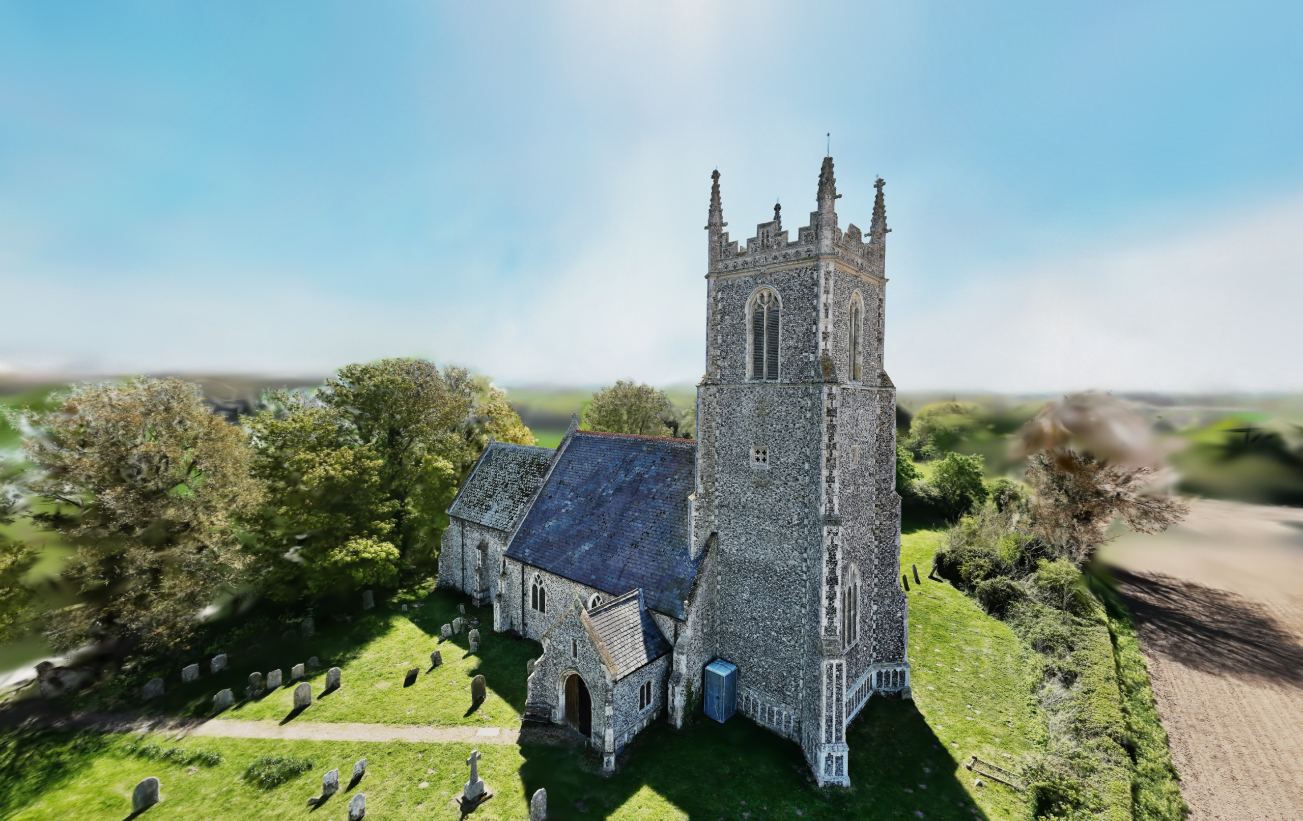
Once the dataset is recorded, post-processing deliverables can be produced for a variety of applications, including Aerial 3D Gaussian Splatting (3DGS) Modelling and high-resolution inspection grids. This extends the value of the original capture, supporting both immersive visualisation and detailed asset review.
By combining Enterprise-grade DJI technology with a qualified and fully insured operator, land mapping becomes a reliable, scalable, and commercially practical solution for modern projects.